April 6, 2021 --
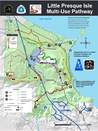
Little Presque Isle
A coming rainy spell meant (to us) that this was
a day to get in one more hike. It was foggy, mid 40's cool, and there was mention of
wind and possible and scattered
showers but that was minor. We'd go to Marquette and walk the Little
Presque Isle trail along the Lake, starting farther north at the parking
lot near the Point and the Isle. The last time we were in that area was
many years ago, part of a local Sierra Club clean-up session with many
of the wonderful people who had been instrumental in saving this special
area from development, allowing us and so many others to enjoy its
incredible array of wonders, where almost every step is a "wow" moment.
When we got to Marquette we stopped at Jean Kay
Pasties to get lunch, going out as usual to local Presque Isle Park to
eat. I'm sure I'm not the only one that gets the two names confused, but
Little Presque Isle - LPI - is about 5 miles north. We
watched rail cars of ore going out on their long, tall dock to
await a freighter to take their load. It was really warm in town, 60
degrees, but cooler here with the wind off the water.
As we drove north to LPI the temperature slowly dropped until it was
back where we started - mid 40's. I replaced layers I'd taken off in
town. We were the only car in the parking lot on this cloudy cool
mid-day but soon another car pulled in beside us with three men out for
a walk. There would be many more when we returned 5 1/2 hours later.
This is a very popular area. Though we were most familiar with the trail
along the Lake (it's also part of the North Country Trail so no bikes)
this special recreation/natural area is about 430 acres, including
Harlow Lake, Wetmore Creek, Hogback Mountain, Sugarloaf Mountain, and
numerous trails and special and historical sites. There just anything
like it anywhere else.
Definitely different than any of our other hikes, in a big way. This is
an incredibly scenic "every step is a photo op" walk. The challenge was
to gaze and marvel at the views without stopping every few minutes,
while at the same time keeping careful eye on the trail, stepping
carefully and deliberately up and down, over and around the abundance of
roots and rocks. Cool and foggy near the Lake, warmer inland, we added
and removed and added layers as we went. The Isle of Little Presque Isle
name disappeared and reappeared in the mist.
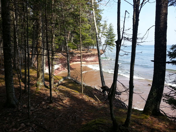
The cliffs along the Lake are interspersed with magical small coves of
beaches, some accessible, some not. The sound of the waves pounding
against shoreline changed as walked along from one to the other. There
is no boring spot along this trail.
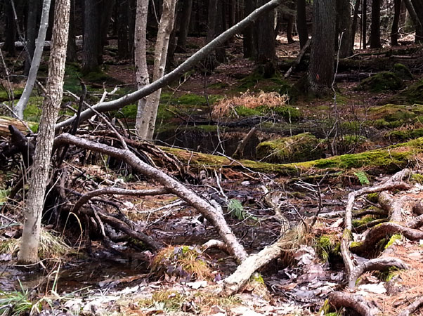
At the southern end we chose to turn west inland, continuing on up
(emphasis on UP) the North Country Trail, instead of going south up the
back of Sugarloaf Mountain which we'd done before. To say this is a
rocky section doesn't come near to an adequate description. Sugarloaf
may get the most attention but it is only one of many and not the
highest (I assume Hogback is). But walking around and up the lesser
cousins here is amazing enough. With a magical bog on one side and huge
rock on the other, this entrance to the inland rock section of the trail
was more than a little special.
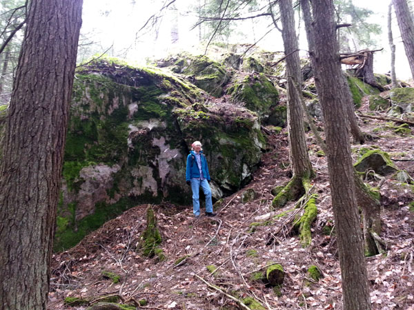
We don't normally do much rock scrambling so this was certainly a
different kind of trail for us. Up a cut between two huge rock (hills?
mountains? outcroppings? I don't know the proper term but they were
definitely big and hard and high and impressive) we carefully stepped
among the old leaves covering a path littered with rocks of multiple
sizes. At that point we both (1) appreciated the good grippy soles of
our shoes, (2) will be looking for a summer shoe with similar sturdy
grip but a smaller footprint, as in no wide sole to catch on nearby
rocks. It was definitely up, and it was great fun, this southern edge of
the Hogback Mountain area and farther north the Huron Mountain Range.
We came down briefly, literally and mentally, to cross CR550 then back
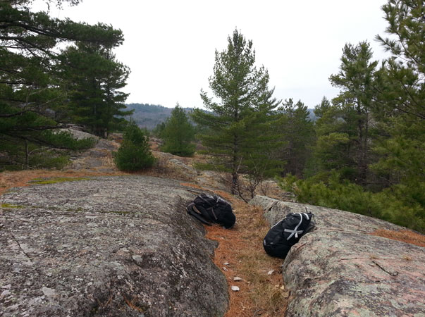
up we went amongst the big rocks. As the trail went by a particularly
inviting smooth rounded rock nearby I called for a break, so we veered
off to climb up on top of this wonderful rest spot. I wondered how many
hundreds (thousands?) of hikers had sat and rested there before us.
Removing shoes and sock we gazed at the incredible views and snacked,
then stretched out on the amazingly comfortable lounge. The sun came
through the haze enough to warm two contented hikers. After a bit, voices
brought us back to the day as a group of hikers went by below our rock.
As they disappeared we re-organized ourselves, tightening shoelaces for
the "back down" trip, and down off our rock we went.
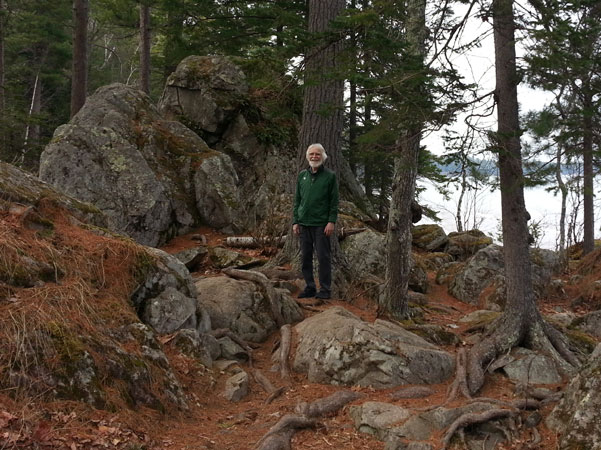
The walk back was as wonderful as the first half, seeing different
views, different wonderings. We were in no hurry (these longer days are
so nice!) and the entire hike was
one of appreciating the moments and the amazing terrain and landscape.
We added layers as we came again closer to the wind off the Lake. We met
more people, particularly near to the parking lots, as it was now "after
work and after school" time. It still wasn't even close to "crowded",
just pleasant company. The north section along the LPI Point has its own
generous landscape of rock to greet walkers coming and going.
The temperature had dropped a few more degrees and I didn't mind getting
into a warm car, heading back into the warmer city to do our shopping at
the Marquette Food Coop. Home along the fog-bound Lake we pulled into
the turn-off on M28 to eat our dinner along side the sound and hidden
view of Lake Superior. The fog lifted as we headed inland and we had a
pleasant trip home. We'll be back, not only to explore again LPI but
some of the other trails, too. In particular we want to continue on the NCT
south and north to see where it goes. There is no lack of hiking to be
done here!
* * * * * *
Copyright
© Susan Robishaw and Stephen Schmeck
|
